Johnson's Mound rises from the flat-as-a-pancake farmland that surrounds the preserve. It's the highest spot that I can think of in all the surrounding county.
The research says it's an ice-age land formation called a kame, but you wonder why all the sediment was deposited in only one spot and not at several locations.
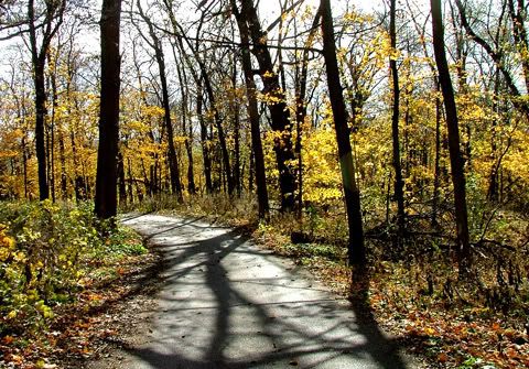
This is the very narrow roadway (one way) that snakes it's way through the woods up to the top of the mound. In the wintertime the eastern slope, which has been cleared of trees, serves as a sledding hill for the kids.
It's a wonderful, peaceful place to spend some quiet time.
3 comments:
Lovely with the yellow autumn leaves and the shadows. My grandpa's land may have had one of these. They had the highest point around with a creek at the base of the mound .. He had a pine grove on the hillside and we played under there. What memories. Cowboys riding the range.... and cowgirls. Knights and forts and dragons. Prairie children in covered wagons. We could really weave some tales.
I love coming across kames. There are some camelback kames at Glacial Park, near Richmond. It's exciting to picture the big chunks of receding glacier sitting where these things now are.
This is a very lovely photo. I wouldn't mind having it on my wall. :)
Post a Comment